Nakhichevan` to Armenia
From the Volume “Challenges of the Republic of Armenia”
Los Angeles – 2014
Author: ARA AHARONYAN
Within the Nakhichevan province of historic Armenia, the forefathers of the Armenian highlands, or the Armenian tribes (according to certain sources), established habitation several thousand years before Christ. Historical-geographical monuments, fortresses and memorials, as well as towns and provinces, bear witness to this. According to tradition and certain inscriptions recorded by the great Hebrew historian Flavius Josephus, the patriarch Noah descended with his family and founded a settlement, calling it the First Resting Place, or Nakhichevan. Thus, according to Josephus, the first records of the settlement go back to the period immediately following the Great Flood.
Traces of prehistoric man have been preserved in the caves of the northern region of Nakhichevan, which served as rock-hewn dwellings for their tribal structures. And in the areas rich in salt mines, tools from the Neolithic era have been discovered, attesting to the beginnings of the art of stone working.
The ram as a symbol
Traces of prehistoric man have also been preserved in the depths of the caves near the province of Goghtn and the villages of Kilit and Kotam, where animal bones have also been found, especially those of bears and dogs.
Geography and nature –
Nakhichevan, considered an inseparable part of the Armenian highlands, with its area of 5,400 square kilometres (2,100 square miles), is located to the south-east of the Republic of Armenia. To the west it has Persia as its border, and to the north-west an 8-mile (12 km.) border axis has also been allotted to the present republic of Turkey.
The northern region of the province has an elevation of 2,300 metres (7,590 feet) above sea level.
Map of Nakhichevan
Nakhichevan, located to the north-east of the water-rich Arax River of historic Armenia, is a plateau at the foot of the Zangezur and Vayots mountain ranges. The Yerjnak and Kuki peaks have formed lakes, and 5 rivers — the Nakhichevan, Yerjnak, Giran, Trunyats (Vanand and Jahuk) — irrigate the plains and river valleys, then join the Arax River. The plain regions of Nakhichevan bear the names of the river valley areas: Sharur, Sandrak, Nakhichevan and Mets Dasht.
And the historic provinces of Nakhichevan numbered six: Goghtn, Sharur, Nakhichevan, Navasar (or Dapanasar), Odsasar and Yerjnak. The historic old city of Jugha (Julfa) is located in the province of Yerjnak, on the bank of the Arax River, in the south-western part of the province.
The Arax River – Border of Nakhichevan
The geographical position of Nakhichevan generally has a temperate climate by nature.
Historical overview –
Nakhichevan, with its historic provinces, formed part of the Kingdom of Ararat (Urartian) in the 9th-7th centuries BC (860-600 BC). In the time of King Aram, who ascended the throne in 860 BC, according to Khorenatsi, Nakhichevan was included in the Kingdom of Van, which was none other than the Urartian Kingdom. According to certain sources, we also encounter the name Askanazyan as the Kingdom of Van.
In 570 BC, as a formed territory and Armenian union, it was included in the Kingdom of the Yervandunis. Certain historiographical records also refer to the Armenian highlands as Hayk or the land of Nairi.
The status of Nakhichevan within the Armenian highlands was to remain relatively the same during the Artashesian dynasty or later the Arsacid dynasty, always being included in the historic province of Vaspurakan.
After the fall of the Arsacid kingdom, the territory came under Persian rule, then, as a result of the Arab invasions, fell into the hands of the Arabs.
In the time of the Bagratuni dynasty, the Arab forces were driven out of Van, and later, in the time of King Smbat Bagratuni, in the 10th century, Nakhichevan also became part of the Bagratuni dynasty. King Smbat entrusted the office of administratively governing Nakhichevan to the prince of Syunik.
In 1045, after the fall of the Bagratuni dynasty, owing to the migratory fate of the Armenian people, Muslim tribes had begun to appear in the territories of Nakhichevan and Syunik. Nomadic Turkic-speaking Oghuz, Turkmens and separate Tatar groupings began, at the first opportunity, to settle in the regions of the cities of Nakhichevan and Ordust.
During the 15th-16th centuries, the Armenian Christian element had gradually begun to diminish, and the provinces of Nakhichevan, at different periods, were under the domination of Seljuk-Tatars, Tatar-Mongols, Oghuz-Turkmens and the Safavid Persian dynasty. It was during this period that the followers of the Muslim religion essentially began their sedentary life.
Later, in the mid-18th century, the Persian authorities, concerned about the expansionist plan of the Russian Empire, which had reached as far as the Caucasus, began to move Muslim masses into Nakhichevan and the surrounding Armenian provinces, who settled there to serve as a bulwark against the Russian advance.
And so Nakhichevan remained under Persian rule until 1828, when Tatars and Persians constituted 40 percent of the population.
By the Treaty of Turkmenchay between Russia and Persia, as an inseparable part of Eastern Armenia, Nakhichevan with its provinces became part of the Russian Empire. And later, in 1849, it entered the composition of the Yerevan province as a regional territory. And so it remained in that situation until 14 July 1918, when General Andranik, having entered Nakhichevan with his troops, declared it an inseparable part of Soviet Russia, which was not to last long there owing to the unrest created by the Tatars.
In March 1919, owing to the withdrawal of the Turkish army from the Caucasus, Nakhichevan became part of the newly formed Republic of Armenia, for a short time. Through the intervention of Turkey, in April of the same year, the territory of Nakhichevan was again to be separated from Armenia, and that status was to remain until 2 December 1920, when, after the Sovietisation of Armenia, the Revolutionary Committee of Azerbaijan was to recognise Nakhichevan, Mountainous Karabagh and Zangezur as territories of Soviet Armenia. But as a consequence of the pro-Turkish Soviet policy of those days, on 5 July 1921, by an unconstitutional decision, Nakhichevan and Mountainous Karabagh were included within the composition of Azerbaijan. As a consequence of this anti-historical decision, in February 1923, Nakhichevan was declared an autonomous region. A year later, on 9 February 1924, Nakhichevan was to become part of Azerbaijan as an autonomous republic, with which it has no physical border.
Statistical picture of the population of Nakhichevan –
From 1918 onwards it has been possible to seek statistical data on the true picture of the population of Nakhichevan. Of a population of 135,000, 40 percent were Armenians (54,000), 22 percent Persians, 20 percent Kurds, 10 percent Azeri-Tatars, and the remaining 8 percent were Russians. At the beginning of the Soviet period, the Persians had retained their Iranian citizenship, while the Kurds and Yazidis, being nomadic, had no citizenship and were engaged in animal husbandry, sometimes crossing into Turkey.
A new phase of Azeri settlement was given impetus in the 1930s, when, owing to Soviet tyranny, the Persian subjects and Kurds were displaced. Gradually, the only Muslim element came to be the Azeris.
In 1960, apart from them, Armenians and Russians lived there as Soviet citizens. During this period, Azeris already constituted 90 percent of the population of Nakhichevan, Armenians approximately 7 percent (9,500 inhabitants), and the number of Russians was 3 percent of the population. After the Armenian depopulation of 1989, when no Armenian remained in the territory of Nakhichevan, the number of Azeris had already reached 282,000, and the remaining Russians numbered around 3,800 inhabitants. It also came to light that around 8,000 residents of Turkish and Iranian nationality who had contracted mixed marriages had settled there after 1990.
An Armenian monastery converted into a mosque
And by today’s figures, the Azeris, who in 1918 constituted 10 percent of Nakhichevan, today constitute 100 percent.
Cunningly exploiting the laws of violence and terror of the Soviet authorities as an autonomous republic, the leadership of Azerbaijan achieved its goal, always keeping the standard of living low, without developing the economy, and keeping certain villages and towns without electricity until 1969.
In the last few years, new information has come to light concerning the autonomous republic of Nakhichevan remaining within the composition of Azerbaijan. According to the recently published book “Nakhichevan, Some Fundamental Issues of the Historical and Modern Period,” after the removal of the Soviet authorities (1991), Kurds of Turkish nationality and from Lachin began to migrate there. And a significant part of the Azeri population has begun to migrate, or has set its sights on leaving Nakhichevan, departing for Russia or Turkey, giving the population statistics a new picture that has begun to concern Baku.
Historic monasteries and monuments –
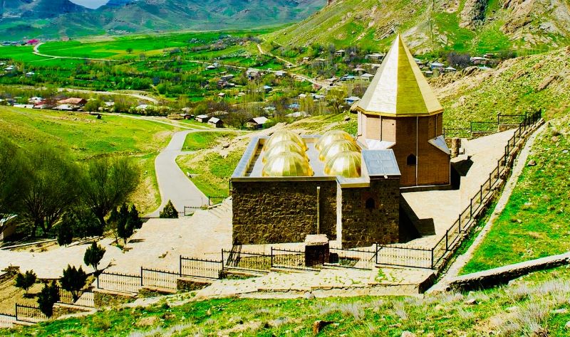
The province of Nakhichevan, with the spread of Christianity in the Armenian highlands, has always had its churches and monasteries as witnesses to worship, even in their ruined state.
Throughout Armenian or various other periods, Nakhichevan has always been part of the Apostolic diocese of Syunik.
According to studies and excavations, there are the ruins of up to a hundred churches and monasteries in the territory of Nakhichevan, many of which were built in the 5th century AD, and which were standing at the beginning of the 20th century, when 80 percent of the population of Nakhichevan were Armenians, until 1914. The Church of S. Karapet of Aprakunis, built in the 8th-9th centuries, was a major pilgrimage site.
The Agulis region had two famous churches, which were eloquent architectural structures:
The Church of the Holy Trinity, built in the 12th-13th centuries, and later the Church of S. Shmavon. Both have been in a ruined state since 1980.
The Church of S. Stepanos of the city of Nakhichevan (later Astapat), which had a fortress structure, also met the same fate and, since 1988, has been turned into a huge pile of stones, destroying the historical inscriptions found there. In the territory of Nakhichevan there existed historical monuments, which were generally khachkars and especially tomb stones.
The majority of the khachkars were located in the cemetery of the historic city of Jugha. The city of Jugha or Julfa (Culfa) was located within the province of Yerjnak, on the northern bank of the Arax River, on the border line between Persia and Nakhichevan. Historically, we first encounter the name Jugha in Armenian literature in the history of Khorenatsi, where it is mentioned as a town.
Since ancient times, Jugha has been on one of the oldest trade routes, being located in the area of the Arax River valley. Passing through various stages of development over time, the town was transformed into a city and, as a prosperous centre with its culture, became a province. During the Bagratuni dynasty, in the 11th century (1019), in the time of Prince Vasak Syuni, it served as the centre of the episcopal diocese of Syunik.
From the Middle Ages onwards, the name of Nakhichevan remains associated with the name of Jugha, even the name of the province of Yerjnak falls into oblivion.
As we noted above, from the 12th century onwards, when the Armenian highlands were subjected to the invasions of the Seljuks, Turkmens, Tatars, Mongols and other Muslims, Jugha was also to suffer the same fate. Apart from certain memorial records, no historical record of cultural revival was obtained there; only the records of pilgrims going to Jerusalem in the 14th-15th centuries have remained standing from the Armenian highlands.
In the 16th century, when Nakhichevan had become subject to the Safavid Persian authority, the population of Jugha, relatively, recorded a certain increase and turned to construction work. The recorded population of cities in the territory of historic Armenia has very rarely exceeded 50,000, and during this period the urban population of Jugha reached that number, according to certain records of 1581.
A period of cultural flowering should be noted at the end of the 16th century, as well as the beginning of the 17th century.
According to certain important sources, Jugha had numerous churches and monasteries. Seven different churches are mentioned within the city of Jugha, among which can be counted: S. Hovhannes Anapat (John the Baptist), Katan, S. Astvatsatsin, S. Amenaprkich, S. Kevork and others.
Jugha was historically famous for the finely carved khachkars of its cemetery, which, according to 17th-century records, numbered around 10,000.
Jugha had been turned into a ruined city by the 18th century. According to the testimony of certain art lovers, there existed 6,000 ram-shaped khachkars, many of which, with their unique style, were moved to the Mother See of Holy Etchmiadzin, and a certain quantity was placed in various museums, including tomb stones.
At the beginning of the 20th century, when 80 percent of Nakhichevan was still Armenian, the khachkars of the famous cemetery of Jugha numbered around 5,000.
During the period of Soviet authority, when Nakhichevan was part of the Soviet Republic of Azerbaijan as an autonomous region, that number had already decreased to 3,000, along with the decrease of the local Armenian population.
This act of cultural genocide reached its peak after the collapse of the Soviet Empire in 1991, when no Armenian lived in the territory of Nakhichevan. From 1998 onwards, the Azeri authorities came forward with a clear plan, when they began to destroy the remaining khachkars of the cemetery. Through fortunate reporting, this news was conveyed to UNESCO, which, through possible intervention, made possible the suspension of that monstrous plan.
Unfortunately, in the autumn of 2002, the destruction of the cemetery’s khachkars continued, and it was possible to film from the Persian bank of the Arax River the destruction of the historic centuries-old heritage of Armenian culture and sculpture.
Forced deportation and Armenian depopulation –
In the time of Shah Abbas, the dominant ruler of Safavid Persia, at the beginning of the 17th century (1604), the first historic step of Armenian depopulation was to be taken as a consequence of the forced deportation of the city of Jugha. A year earlier, when the Shah, on a three-day visit, had been captivated by the prosperity of the city of Jugha within his empire, he had decided to move the Armenian population living there to northern Persia, to the region of Tabriz, to disperse them and assimilate them with the Muslim tribes living there. The following year that plan was to be implemented; the populous and thriving city, with its cultural life, was to be destroyed. And not only that, but in the following years its beautiful structures were to be demolished. All this was carried out through Tahmazghuli Beg, who succeeded in scattering the Jugha inhabitants throughout the region of Tabriz.
Shah Abbas, thinking that the Armenians subjected to forced deportation would carry out constructive work in his empire, promised to establish a city named New Jugha in the region of Tabriz and to settle the deported Armenian population within the region of New Jugha. This was to be a diplomatic approach for Persia, keeping the Armenians away from the nearby borders of the Russian Empire, especially from Nakhichevan.
During the following two centuries, Nakhichevan should generally be considered depopulated of Armenians, until the implementation of the Treaty of Turkmenchay, after which it became possible for nearby Armenian villagers to take refuge in certain surviving villages and towns of Nakhichevan.
Gradually, 60 percent was to consist of the Armenians of Nakhichevan, especially after it was named a province of the Yerevan governorate.
After the above-mentioned declaration of General Andranik in 1918, when Nakhichevan became part of the newly formed first Republic of Armenia, various military units were to be formed in the territory of Nakhichevan. But the withdrawal of the Turks from the region was not to be sufficient, because, together with their Azeri-Tatar co-religionists, they set to work with the plan of realising their Turanian dream. Slaughter and massacre again became inevitable in the border villages. A faithful example of those days of the Turanian dream should be considered the following expression of the commander of the Turkish army, Vehip Pasha, during the Batum conference in June 1918, a year earlier, addressed to the Armenian delegation: “We withdrew from the Balkans and Africa, but we shall spread towards the East; there is our blood, our religion and our language. We must have a road to Persia, demanding Nakhichevan and Zangezur, then descending into the Aras valley and going to Baku, for which you (the Armenians) constitute an obstacle.”
This expression clearly revealed the plan of the Turks and the project of the advance of the Turkish army. From the north, Akhalkalak and Kars were to yield their presence to the Turkish army, so that they would have a way to reach Kazakh and Ganja, and from the south, starting from Nakhichevan, they were to reach the Kura River.
The Turks had planned to reach Baku by two different routes, and in that way they were to isolate the Armenian state from the Soviet order, and from the south, from the less friendly Persia.
With the Sovietisation of the Armenian Republic in 1920, according to the Yerevan treaty of 2 December, the Soviet government was to undertake to unquestionably protect the lands belonging to Soviet Armenia, keeping them as property within the borders of Armenia.
However, the very next day (3 December), by Article 13 of the treaty, Sharur and Nakhichevan were to be temporarily under Turkish administration. A few months later, this decision was further reinforced, and Nakhichevan was entirely deprived of Armenian statehood, when on 16 March 1921 the Soviet-Turkish alliance was signed in Moscow.
Three articles related to that alliance (arts. 3, 5 and 15) concern the fundamental issue of Nakhichevan.
By the points stated in those articles, it is only the Armenian state that suffered, and Nakhichevan was henceforth composed of a majority of Muslim elements (52 percent).
And later, on 23 July 1923, by Stalin’s arbitrary but planned decision, Nakhichevan became an autonomous Soviet Socialist Republic (Nakhichevan Mukhtar Soviet Socialist Republic), and the issue related to it was the 12-kilometre-long border of Turkey with Nakhichevan along the bank of the Arax, which was realised in the time of Mustafa Kemal, by ceding certain territorial leverage to Persia.
In the last years of the Soviet authorities, Turkey’s small border advantage with Nakhichevan became more evident, when they delivered various commercial aid to their Azeri-Tatar brothers. Especially during the Karabagh movement (1988), and particularly during the Armenian-Azeri clashes around Yeraskhavan, even supplying ammunition.
Today, the depopulated historic Nakhichevan compels us to recognise it as Armenian-owned territory of the Armenian highlands. Especially its fundamental importance presented to foreigners, keeping away the designation of Rasul Zadeh as “Nakhshi-Jahan,” which translates as the ornament of the world.
Let that “ornament of the world” be the inseparable obligation of the pursuit of the Armenian Cause and our Great Dream, because its being Armenian-owned is indisputable.
SOURCES USED
1. Armenian Concise Encyclopaedia, Yerevan, 1999 (Volume II).
2. “Jugha,” Argam Ayvazyan, Yerevan, 1987.
3. Collection of Treaties in Force, Moscow, 1935.
4. Inter-ethnic Struggles, E. Zohrabyan, Yerevan, 2000.
5. Galust Galoyan, Armenia and the Great Powers (1917-1923), Yerevan, 1999.
6. Britain and the Armenian Question (1915-1923), Agapi Nasibyan – Nicosia, 1994.